


By ZAIDA GLIBANOVIC and TOM HAYES
THUNDER only happens when it’s raining – and apparently in the middle of our great Aussie summer.
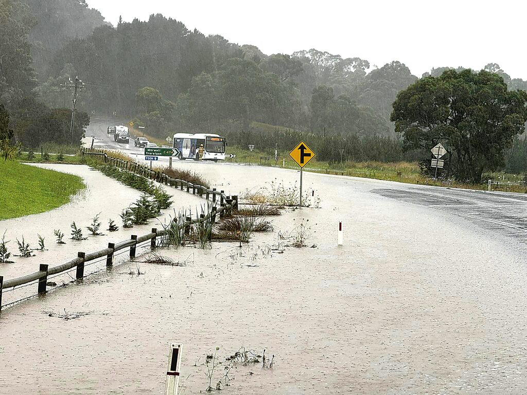
A wild 44.8 millimetres of rain fell on the Latrobe Valley from Monday to Tuesday last week.
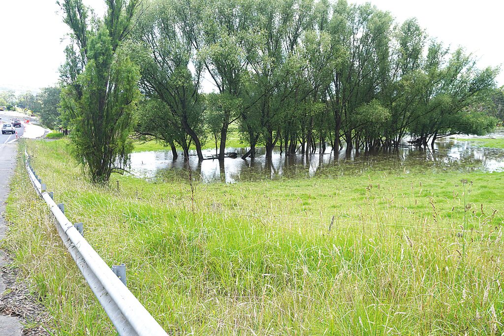
The Tanjil River, Latrobe River through Yallourn to Traralgon Creek all experienced riverine floods. A number of low-lying areas, paddocks and roads in the region were affected by the heavy rainfall, resulting in many road closures.
The Yallourn North Urban Fire Brigade’s tanker sat at the intersection of Brown Coal Mine Road and Tanjil East Road on Monday, January 8, diverting traffic away from the area.
There was a large amount of water over the road, causing dangerous driving conditions. Emergency service crews urged the public that flood waters are dangerous and must not be driven through.

The most recent thunderstorm comes after the region was battered by wild weather across the holidays.
After the wettest start to summer, many would be left wondering why we aren’t seeing drier conditions since the Bureau of Meteorology (BOM) declared an El Niño event in September.
In each issue of the Latrobe Valley Express, we have published articles warning of the bushfire threat while simultaneously reporting on flooding events across the region – so why the two extremes?
Despite all the rain, University of Melbourne researchers Dr Andrew King and Professor Andrew Dowdy say the summer is much more likely than normal to be a hot one.
“Much of eastern Australia has seen wetter than normal conditions over November. Vigorous low-pressure systems and thunderstorms brought record rain totals and flooding to parts of Victoria,” they said.
“Overall, this meant November was wetter than average across the continent. But as we had a record dry September and a dry October (apart from in eastern Victoria), spring was actually drier than average for Australia as a whole.”

When we think of El Niño we usually think of the scorching summer sun, but scientists say it is not always the case.
“It’s not as simple as El Niño hot and dry, La Niña cool and rainy. The influence of this phenomenon is complex and non-linear,” the Melbourne University experts say.
The exceptionally high sea surface temperatures in Australia’s south-east contribute to the rain since they can potentially increase air moisture content and precipitation in the area.
Even if droughts are more common on average, we should still be ready for floods during El Niño episodes, the scientists maintain.
“You would expect that with an event like La Niña, we would experience more thunderstorms. However, there is no significant correlation between thunderstorms and any of these climatic cycles. This is significant since many of the large rain events that occur in Australia during the spring are often caused by thunderstorms,” they say.
Though you can’t predict the weather, the BOM is forecasting above average rainfalls in the next couple of months across the south-east accompanied by warmer conditions especially at night.
On Wednesday, January 10, days after repeated rainfall, the Latrobe River rose higher than expected, flooding the newly-opened Latrobe River Bridge.

The river burst its banks after steady rain, spilling over the road to the south, flooding neighbouring farmland.
The Nationals Member for Morwell, Martin Cameron, said the state government was told the causeway needed to be raised during the bridge build to prevent situations like this.
“It’s also clear that even with moderate rainfall, the Tyers Road causeway will continue to flood, blocking access to the bridge,” Mr Cameron said.
“The owner of the farmland next to the bridge told me the paddock he’d shifted his cattle into hadn’t flooded in 30 years – until today.”
Bus lines to and from Tyers was suspended, and the road was closed, leaving residents in the dark about when it would reopen.
However, Tyers Road was reopened just under 24 hours later, but restricted to one lane, and it still remains susceptible to flooding in the future.


