


By KATRINA BRANDON
AN EARTHQUAKE rumbled through the region in the early hours of last Saturday (October 8).
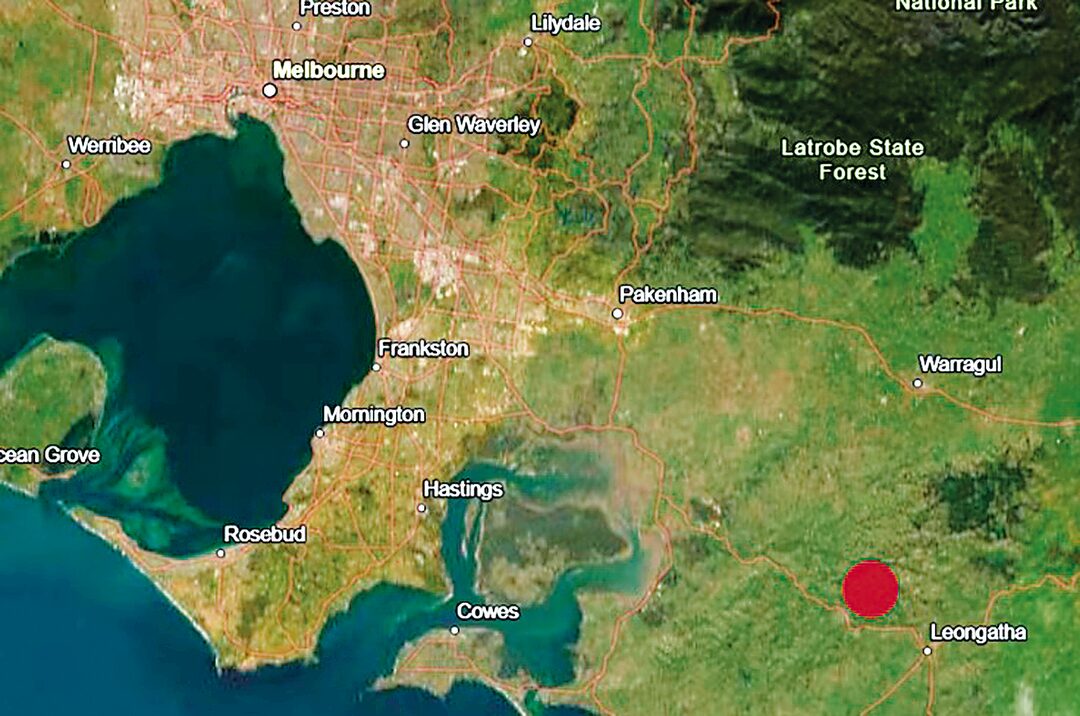
A magnitude 4.8 earthquake struck Arawata around 2am, and was felt as far as Moe and even Longwarry.While there was no community threat, the quake ignited conversation on community pages later in the day.
“At just after 2am on Saturday morning, there was a magnitude 4.8 earthquake about 6 km north-east of Korumburra, and 100 km south-east of Melbourne,” Earthquake Geologist in the Monash School of Earth, Atmosphere & Environment, Faculty of Science, Dr Dee Ninis said.
“The earthquake was widely felt across the state, waking many people from their sleep, with over 20,000 reports received by Geoscience Australia. It was followed by hundreds of aftershocks, the majority of which were too small to be felt. The largest so far was a magnitude 3.1 less than an hour after the main shock.”
More than 16,000 reports were made by the community via the Earthquakes@GA website. Felt reports provide situational awareness to Australian emergency management agencies. They also inform Geoscience Australia’s hazard modelling, which helps keep Australians safer.
A mere nine hours before the main earthquake, a magnitude 3.1 started the night’s events, with the main one at 2am; another 25 minutes later, a magnitude 2.5 near Ranceby; a 3.1 near Arawata at 2.56am; and a weaker one later that afternoon (24 hours after the first one) measuring a magnitude 2.7.
Before this groundbreaking event, two separate events occurred near Woodside and Yarram a week earlier. The first was on September 24, measuring around magnitude 3, and the other was on September 30, measuring magnitude 3.1.
“Earthquakes can and do happen anywhere in Australia; the Gippsland Basin is a region of heightened seismic activity relative to some other regions, and Korumburra is no exception,” Dr Ninis said.
“In 2009, a magnitude 4.7 was followed by a similar magnitude earthquake about two weeks later. The same area experienced a magnitude 4.4 quake in 2011.
“The area is known for several geological faults which first accommodated extension of the earth’s crust to form the Gippsland Basin more than 100 million years ago.
“In more recent times, in the last five million years, these faults were reactivated to accommodate compression of the crust, resulting in uplift and mountain building. These compressive forces continue in the present day, and earthquakes like the one this morning are the sudden release of stress that has built up in the crust as a result of these forces.”
Dr Ninis said the aftershock from the Arawata earthquake could be felt for days or even weeks, and that they will be smaller and less frequent.
In addition to local shore movements, Kaimata, New Zealand, also felt a magnitude 5.0 earthquake.
For more information on seismic activity, go to: https://earthquakes.ga.gov.au/event/ga2026tnibno