Gregor Mactaggart
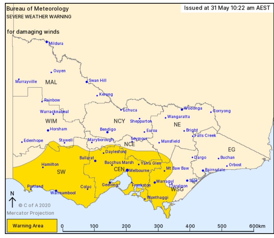
MOE features among the towns listed in the severe weather warning for damaging winds issued by the Bureau of Meteorology.
The south-westerly winds are expected behind a cold front moving across the state on Monday.
Winds, averaging 60 to 70km/h are expected to develop from the west on Monday morning, moving eastwards and impacting the Melbourne metro area during the afternoon.
Peak wind gusts are expected with showers and isolated thunderstorms and are more likely to be experienced in coastal areas and along elevated terrain
Winds are expected to contract to the eastern part of the warning area during the late afternoon, easing on Monday evening.
Timing and location of the strongest winds will is dependent on a developing low pressure system near the southwest coast on Monday.
Locations which may be affected include Moe, Warrnambool, Ballarat, Geelong, Melbourne and Bacchus Marsh.
The State Emergency Service advises that people should:
* Be aware that trees that have been damaged by heat or fire may be unstable and more likely to fall when it is windy or wet.
* Check that loose items such as outdoor settings, umbrellas and trampolines are safely secured and move vehicles under cover or away from trees.
* Stay indoors and away from windows.
* If outdoors, move to a safe place indoors. Stay away from trees, drains, gutters, creeks and waterways.
* If driving conditions are dangerous, safely pull over away from trees, drains, low-lying areas and floodwater. Avoid travel if possible.
* Stay safe by avoiding dangerous hazards, such as floodwater, mud, debris, damaged roads and fallen trees.
* Stay away from fallen powerlines always assume they are live.
* Stay informed monitor weather warnings, forecasts and river levels at the Bureau of Meteorology website, and warnings through VicEmergency.


